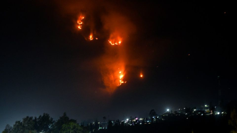
Arya News - The latest blaze is the second wildfire to hit the Mount Bromo area in about a month, underscoring heightened fire risk during the dry season.
SURABAYA – A nother wildfire broke out in Indonesia’s Mount Bromo National Park in East Java on Thursday, weeks after a major blaze scorched more than 1,000 hectares of the protected conservation area.
According to local authorities, the fire was detected at around 4 p.m. in Ngadas village, Probolinggo regency. Strong winds caused the fire to quickly spread toward popular tourist spot Teletubbies Hill, raising concerns that the blaze could expand further.
The fire prompted the Bromo Tengger Semeru National Park Authority (TNBTS) to close some tourist access routes on Thursday to support firefighting efforts and protect visitors, said TNBTS head Rudijanta Tjahja Nugraha.
The closure was expanded to all access points on Saturday, covering entrances to Mount Bromo from Malang, Probolinggo, Pasuruan and Lumajang, the authority said.
“To make firefighting and fire management more effective, visits to Mount Bromo from all access points have been completely closed,” Rudijanta said on Sunday.
The TNBTS authority has not set a date for reopening the tourist area, he added.
The East Java Disaster Mitigation Agency (BPBD) said thick smoke, strong winds and steep terrain were hampering efforts to contain a wildfire in the Mount Bromo area.
Satriyo Nurseno, head of the agency’s emergency and logistics unit, said the BPBD began aerial water-bombing operations on Friday as ground crews faced difficult access to the fire.
The helicopter conducted 17 sorties on Friday, dropping a total of 17,000 liters of water on the fire, Satriyo said.
“However, the operation was later suspended because thick fog reduced visibility and made it unsafe for the helicopter to continue flying,” he said on Friday
Meanwhile, members of a joint response team remained deployed in the area to monitor the fire and prevent it from spreading to lower-lying areas.
Dry-season conditions in East Java are expected to further complicate efforts to contain the Mount Bromo wildfire, with wind speeds forecast to reach 48 kilometers per hour across much of the province between Saturday and Monday, the Meteorology, Climatology and Geophysics Agency (BMKG) said.
“The stronger winds could increase the risk of the fire spreading,” said Taufiq Hermawan, head of the Juanda Meteorological Station in Sidoarjo on Sunday.
Strong winds at the Mount Bromo fire site have also contributed to thick smoke in the surrounding area, reducing visibility for motorists and creating additional safety risks.
The BMKG said strengthening easterly winds from Australia, driven by differences in air pressure, were a key factor behind the increase in wind speeds.
Taufiq urged residents to avoid burning trash or other materials, warning that fires could spread quickly and become difficult to contain.
The latest blaze is the second wildfire to hit the Mount Bromo area in about a month, underscoring the heightened fire risk during the dry season.
A previous fire broke out on Aug. 3 in the Bantengan block, burning about 1,120 ha, according to authorities.
The blaze damaged vegetation and disrupted the ecological functions of the protected conservation area, while also affecting tourism, a key source of income for communities around the park.
Following the latest fire at Mount Bromo, the Forestry Ministry has formed a special team to investigate its cause and examine possible violations of the law.
Aswin Bangun, head of the Forestry Law Enforcement Agency for Java, Bali and Nusa Tenggara, said investigators were currently examining information gathered in the field, including through site inspections, evidence collection and analysis of facts identified at the scene.
“Further investigation is also being carried out with experts to strengthen the scientific evidence,” Aswin said.
The team includes forest fire expert Bambang Hero Saharjo and soil damage expert Basuki Wasis, who will conduct scientific assessments of the cause of the fire and its impact on the conservation area.