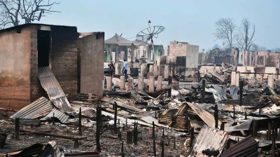
Arya News - Environmentalists allege that the Indonesian government has been restricting crucial geospatial data by openly threatening criminal charges against critics – in a move deemed to silence discontent over its handling of widespread forest fires.
JAKARTA – The Forestry Ministry is accused of restricting data amid widespread wildfires raging the country, as it threatens criminal charges against unauthorized copy and use of geospatial data crucial for tracking deforestation and fire hot spots.
A pop-up notification appears on the ministry’s unified interactive mapping platform Sigap since last month, warning visitors that the once freely accessible database is now “view-only” and restricting people from “retrieving, extracting or converting” the information without prior written approval.
People must now consent to terms and conditions stating that violations of the restrictions constitute a criminal offense punishable under the draconian Electronic Information and Transactions (ITE) Law and a 2011 law on geospatial information.
Further violations, which include altering or trafficking the data, may result in up to nine years of imprisonment and or a maximum fine of Rp 3 billion (US$167,420).
The Sigap platform has long served as the official source of wide-ranging geospatial forest data, from deforested and burned regions to the zoning of conservation landscapes in Indonesia.
Environmentalists and academics interviewed by The Jakarta Post said they mostly used the data to track illegal forest clearing, habitat fragmentation or wildfires by overlaying the government’s deforestation map, for instance, with business concessions or conservation zones.
In doing so, they were able to to monitor forest loss or unlawful corporate practices in a specific area, as opposed to the database that mostly contains low level of geographical and land-use details.
But the new restrictions have fueled fears among environmentalists.
“We are now beginning to feel anxious about using the data from the platform,” Jambi-based Green Foundation executive director Feri Irawan said on Tuesday, fearing the prospect of prosecution.
Feri and his colleagues have often just screen captured maps of burned forests from the Sigap webpage and overlaid the data with their own analyses, such as looking into how the persistent blazes had fragmented the habitat of endangered Sumatran elephants.
Securing a written permit as suggested by the ministry would require wading through hefty paperwork and bureaucratic hurdles, said Feri, who now prefers using third-party sources.
Greenpeace Indonesia senior researcher Sapta Ananda described the restrictions as “very troubling”.
“Although we are still able to analyze the data,” he said, “but we’ll ultimately be afraid to publish it or to cite references from the ministry.”
Weaponizing data?
Agung Wardana, an associate environmental law professor at Gadjah Mada University (UGM), said the heightened data restriction could not be detached from the context of the wildfires currently overwhelming the archipelago.
He alleged the government has been “weaponizing” the data to silence discontent over the handling of forest fires by openly threatening criminal charges against critics.
“This is a strategic measure to curb public participation, a pattern that has long marred the ministry,” Agung said.
Meanwhile, public access to geospatial data, he said, could amplify grassroots activism in protecting the environment, particularly at times when state accountability is crucially demanded.
Rising data secrecy is also feared to hamper the environmental protection in the country, said Indonesian Center for Environmental Law (ICEL) executive director Lasma Natalia.
Forestry Ministry spokesperson Ristianto Pribadi said the public would still be able to download certain types of maps in JPG or PDF formats without a prior written permit. However, only those from state agencies and universities are eligible to access the shapefile format of the maps, which enables users to analyze data in more detailed scales.
In 2017, Greenpeace lost a cassation it filed at the Supreme Court over request for shapefile maps of forest cover after months-long legal battle against the then environment and forestry ministry.
Sapta of Greenpeace said the limitation reduced the ability of independent analyses to closely monitor forests in greater scales.
“This indicates a fear over new information that may be obtained from [independent] analyses of the [excluded] maps.”
The Forestry Ministry has since maintained commitment to transparent and accountable environmental governance, saying it respected the roles of public monitoring on forest management.
Read More:
Five arrested for corruption at Indonesia disaster agency amid funding concerns
ASEAN urged to take extra measures on regional haze amid rising health concerns
Indonesia’s Flores quake victims demand government accountability over slow disaster response